Blog 4 – “Bound for South Australia” – January 2008
Happy New Year everyone!
Our previous blog finished as we left Louth, on the Darling River in New South Wales. From there we followed the Darling downstream as it meandered past Tilpa to Wilcannia, then departed the river, heading west to Broken Hill for a few days.
At last, and with a sense of relief, because we, and no doubt some of our family and friends, were starting to wonder whether we would ever leave NSW, we headed further west and crossed the border into South Australia.
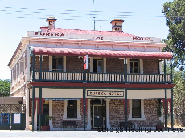
Although the countryside had similarities to the Broken Hill region, we noticed subtle changes as we drove. We passed through rolling, folded hills, a foretaste perhaps of the Flinders Ranges. The towns also changed. As we drove into Peterborough, we had our first glimpse of the lovely old sandstone buildings, dating from the mid 1800s, which are a feature of South Australia’s towns. We spent our first night in Jamestown, another picturesque rural town.
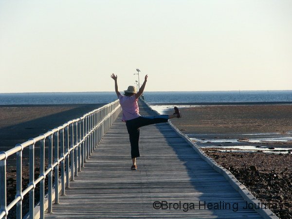
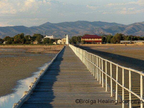
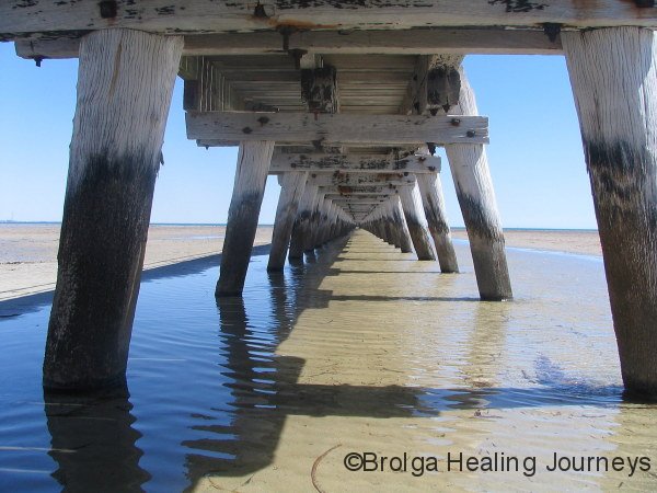
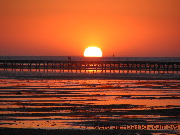
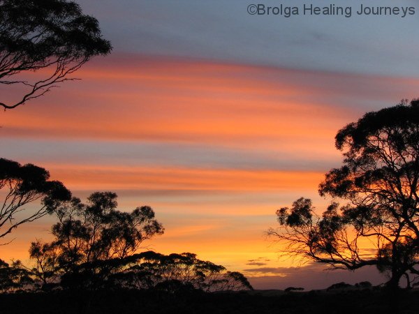
We seemed unable to rein in our drift westwards, continuing the next morning until we reached the Spencer Gulf, staying at Port Germein for several days. This quiet, pretty little fishing village boasts Australia’s longest wooden jetty, at around 1500 metres (yes, we did the walk out and back several times), views of the coastal Flinders Ranges, and Australia’s most voracious sandflies, which established a close relationship with Peter.
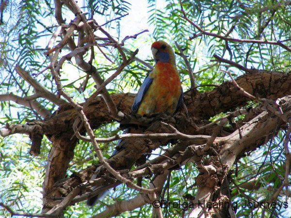
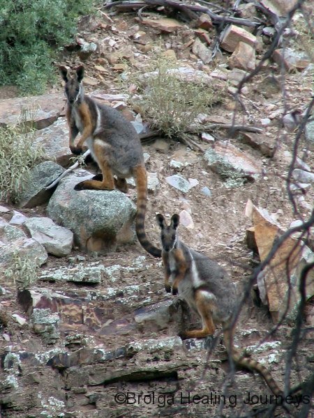
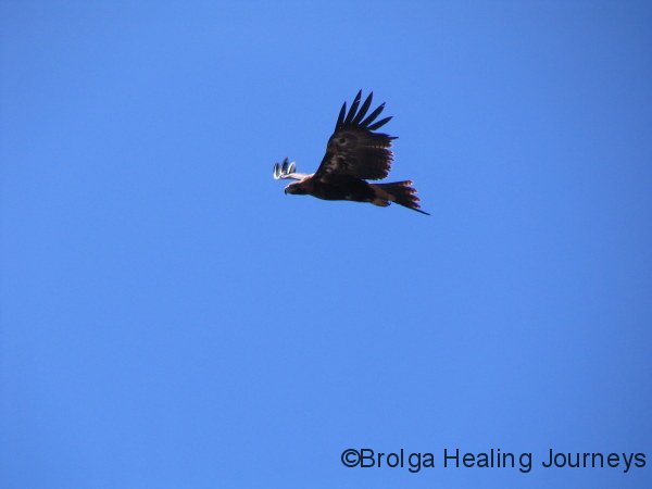
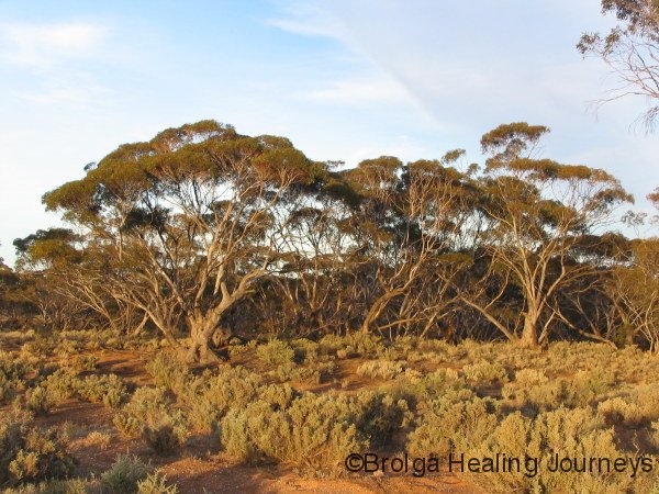
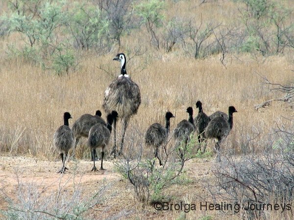
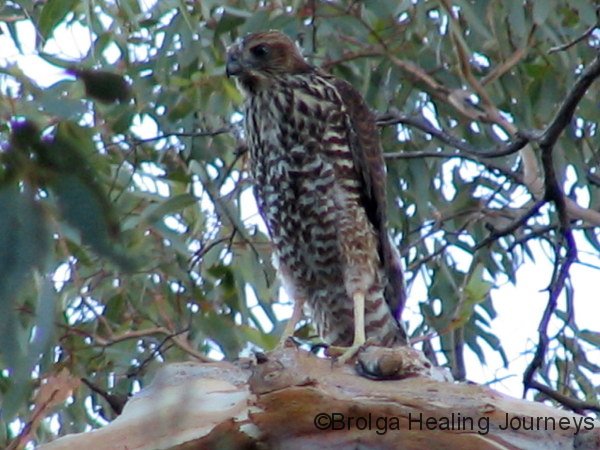
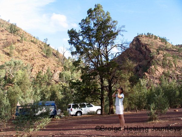
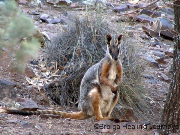
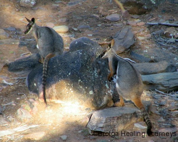
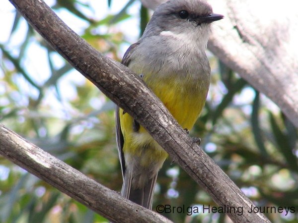
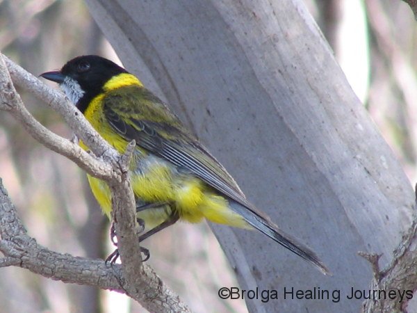
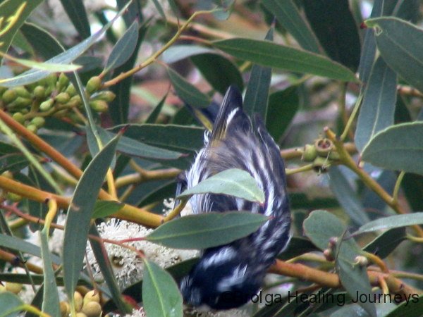
Our first taste of the Flinders Ranges came with our stay in the aptly named Mt Remarkable National Park. We had a beautiful campsite at Mambray Creek, which unlike most of the creeks on our trip was actually flowing. We were surrounded by huge gum trees housing a variety of birds including Adelaide Rosellas (a sub-species of the Crimson Rosella we all know and love in Canberra), Kingfishers, Galahs, Spiny Cheeked Honeyeaters and Australian Hobbys (similar to Falcons). On the ground we spotted Euros – a small long haired species of kangaroo, which we have renamed “Aussies” for obvious reasons, Western Grey Kangaroos and, most excitingly, the rare, endangered, and absolutely beautiful, Yellow-Footed Rock Wallabies. Colonies of these wallabies are slowly but steadily recovering in the Flinders Ranges as National Parks in South Australia continue an aggressive program to reduce numbers of feral foxes, the main predator of the wallaby.


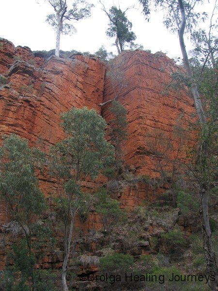
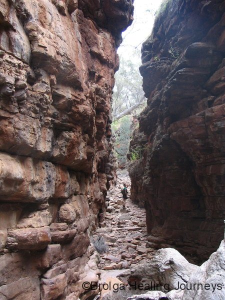
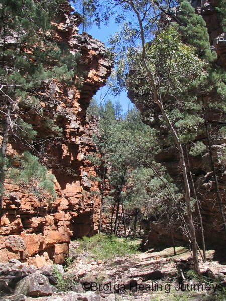
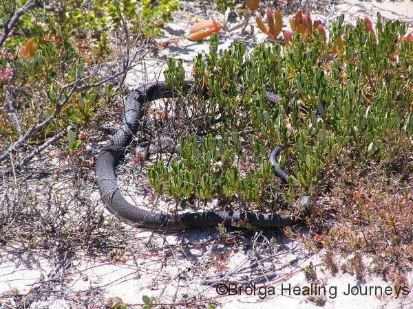
We managed a number of the bushwalks from our campsite– including to Davey’s Gully, Sugar Gum lookout, the 18km Hidden Gorge hike (Peter alone) featuring towering red cliffs for many hours, and the following day the 13km ascent of Mt Cavern (Peter alone again, a sucker for punishment). We also drove up the range to walk in Alligator Gorge, with its unbelievable rock formations and narrow gorges, and fleeting glimpses of the Krebbe Tiger Snake, a sub species of the tiger snake found in the coastal region of the Flinders and also on a number of islands off the South Australian coast. Peter isn’t particularly fond of snakes, and has developed a finely-tuned snake radar able to detect a snake at a thousand paces; his radar has been in great use during the trip!


After five days at Mt Remarkable we dragged ourselves away, heading south to Adelaide. En route, we had a pleasant lunch stop in the historic town of Redhill and, further south, were both impressed by Port Adelaide’s old buildings. We stayed overnight at the caravan park in West Beach, Adelaide; not our favourite stay, though we had been spoilt with our recent bush campsites, far from the madding crowd.
We called in the following morning to Adventure Offroad Campers in Adelaide (the manufacturers of our camper trailer), where we had some minor maintenance to our camper, and were pleased finally to meet Paul Tabone who heads the operation; all previous contact with him had been by phone and email. We continued our travels south, stopping at McLaren Vale; who could guess why we tarried there!
Peter had visited the area in the early 1980s (with another little “chickie”), when he was a fresh-faced university student– and was in the area just before the Ash Wednesday fires, indeed he watched the Adelaide Hills burn as the fires struck. This proved to be an eerie coincidence, as the weather on our arrival in McLaren Vale in December 2007 was extremely hot, with ash and smoke in the air, and a dramatic thunderstorm that brought no rain. We learned the following day of fires in the region just to the north of McLaren Vale, but also of the Kangaroo Island fires and the devastation they continued to wreak. We had planned to visit Kangaroo Island next on our journey but as the fires continued to burn, decided to head north instead. We were both desperately distressed for the island, having seen the damage caused by bushfires to the Canberra region. The media understandably focuses on people and their tragedies, and on losses to livestock and property, but usually fails to emphasise the loss of wildlife, plants, and damage to the wilderness.
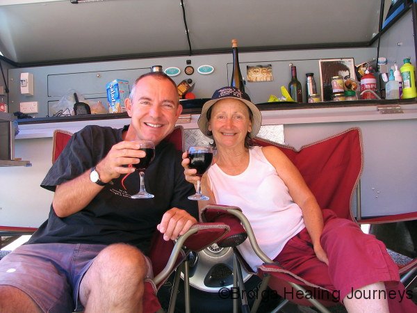
But onto a more positive note! McLaren Vale is a very friendly region, with picturesque rolling hills dotted with wineries, olive groves and historic buildings. Although it has become more heavily settled and developed, Peter was thrilled to find the area just as friendly it was many years ago. We visited a number of wineries, discovering many beautiful wines; we had to throw out all non-essential items to accommodate the wines we purchased – only joking. Our most memorable experiences were at Primo Estate, where wine tasting is taken to an art-form and accompanied with locally made breads, grand-prano cheese and olive oils; talking to Margaret Maxwell (a living national treasure!) of Maxwell’s Wines and Meads; a lovely intimate Friday afternoon tasting at Kay Brothers Wines; and visiting Samuels Gorge winery with its magnificent views, exquisite wines and enthusiastic, eccentric winemaker, Justin McNamee. We had intended to stay one night in the town and ended up staying four.
We headed inland and north from McLaren Vale, wandering our way through a succession of interesting towns along the Adelaide Hills, stopping in Hahndorf for lunch. The town is quite “touristy”, but is redeemed by its many old buildings and our favourite, a tremendous gallery of Aboriginal art. We could easily have blown our savings there but sanity prevailed and the journey could continue.
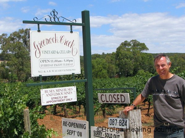
We continued north through the Barossa Valley where, against all odds, we resisted the urge to visit more wineries. It must be admitted at this point, however, that Peter somehow managed to “chance upon” Greenock Creek winery. Not unexpectedly, they were sold out of this year’s release and closed – but at least he has seen the hallowed land of his favourite wines. Despite a quick photo stop there, and Peter’s whimpering as we drove past one iconic winery after another, we emerged from the Barossa without having sampled (or more importantly, bought), any wines of this region. Not due to any great exercise in self control; more to the fact that all available space was taken up with wines from McLaren Vale.
A long day’s travel ended with us camped in the Clare Valley among towering gum trees. Okay, so we did go to a couple of wineries there. Most notable were O’Leary Walker wines, and the historic Jesuit-run winery of Sevenhill.
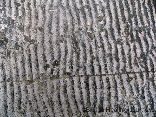
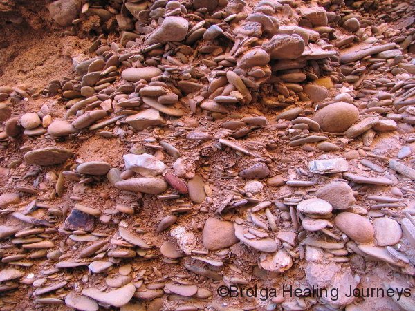
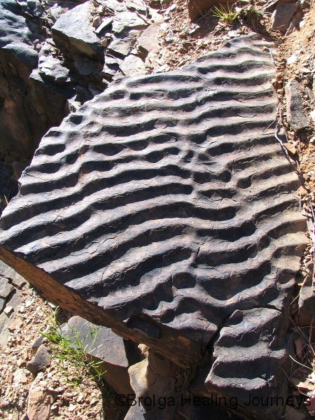
We’d had enough of civilization, so upon leaving Clare we travelled north-east to Burra, then into the bush again, camping for a number of days within the Redbanks Conservation Reserve. Talk about an area of contrasts. The name of the reserve derives from the series of erosion gullies lining the main creek and branching out from it. The red soil cliffs tower some thirty metres at their highest, and are extremely fragile. The cliffs, by all accounts, have existed for many thousands of years, but the process of erosion has accelerated following European settlement and agriculture. The various layers of rock, sand and sediment within these cliffs fascinated us, although we remained wary that at any time the cliffs may collapse and claim us to themselves.
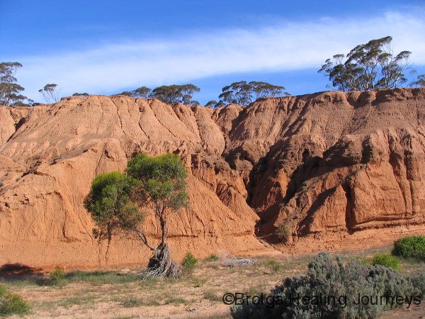
The reserve also contains a series of permanent waterholes, featuring the healthiest Western Grey Kangaroo and Euro (Aussie) populations we have seen on our travels, along with abundant birdlife. The water holes were used tens of thousands of years ago by the then-resident mega-fauna; indeed the Redbanks area is renowned as one of the world’s richest deposits of mega-fauna fossils. For both of us, it felt like we were walking into an ancient oasis in an otherwise desiccated region.
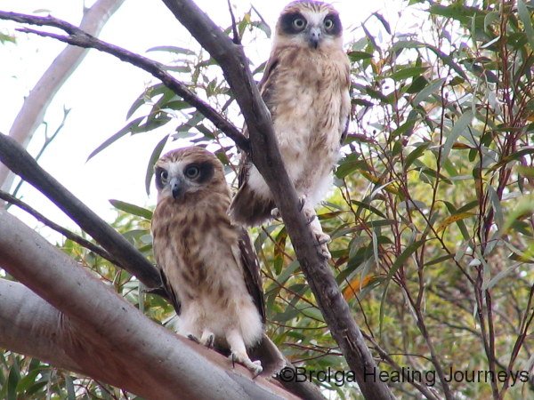
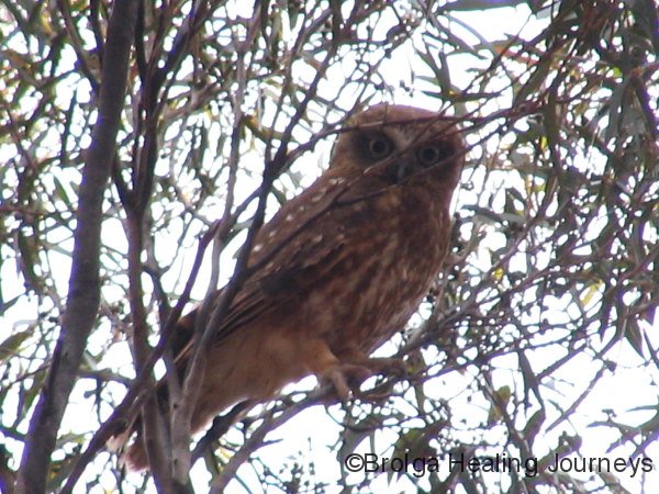
Nirbeeja, as you are probably aware, has a particular interest in birds and has become finely attuned to their world. One morning, upon hearing a distant fracas in the surrounding mulga, she disappeared from the campsite. She emerged, some time later, thrilled to have spotted two juvenile Southern Boobook owls and their parent. The reserve also conserves a stand of ancient mulga – quite rare in a region where most available wood was logged by early white settlers. The remaining stands of trees have been dated to more than three hundred years, a glimpse into an Australia that existed before white man settled our shores.
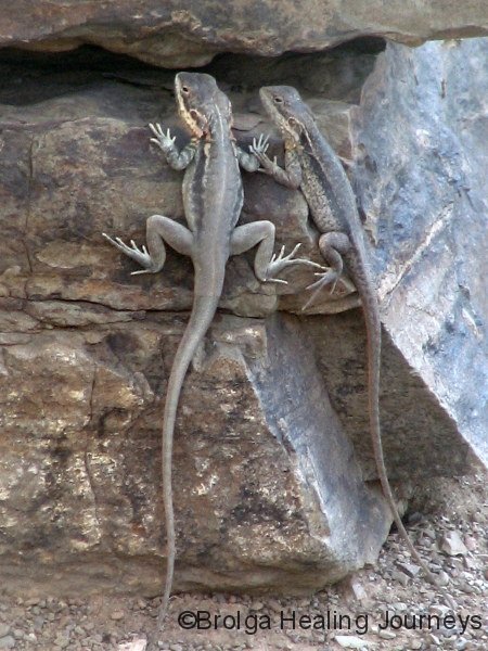
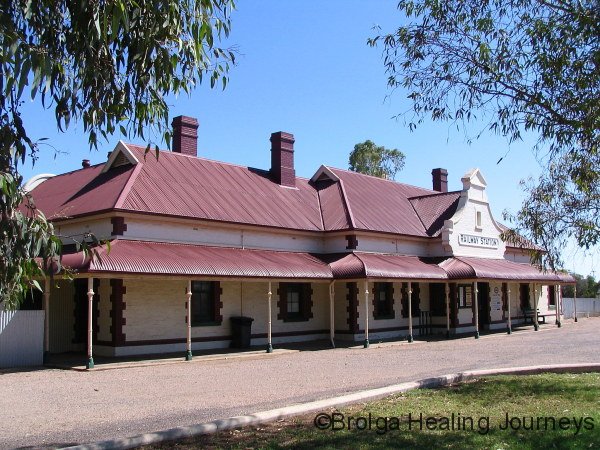
Leaving Redbanks reserve, we travelled north into the heart of the Flinders Ranges, through a series of historic towns. Like many inland Australian towns, they are struggling to survive, in their case following the cessation of most rail travel through the region; now tourism provides their life-blood. Terowie impressed us, as did Peterborough, where we camped overnight, this time as we headed through the town on our way north. We had the pleasure to visit a place called Dragon’s Rest in Peterborough, a refuge for Bearded Dragon lizards being set up by a couple on their small acreage that once served them as an organic market garden. The refuge is a credit to them and a testament to the work they have put in over many years. There was a feeling of “Findhorn” about the place, of something magical happening within those gardens.
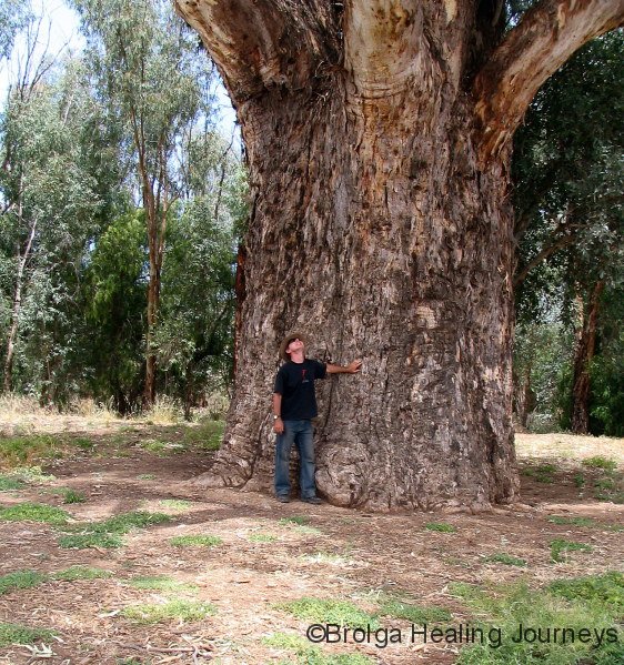
From Peterborough we set sail to Wilpena Pound, stopping for lunch at Orroroo, where we were awed in the presence of a giant red gum estimated to be over 500 years old. Such was its vitality, we quite expect it to last another 500.

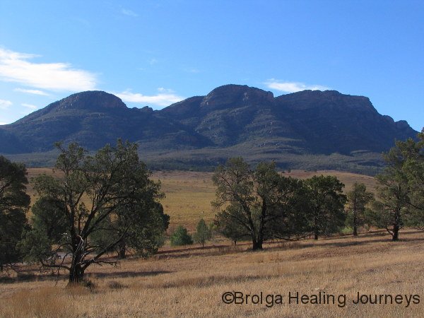
Finally we arrived in the Flinders Ranges National Park, making camp at the Wilpena Pound Resort. The Resort is well set up and quite unobtrusive, just as it should be in such stunning natural surroundings; there were quite a few people staying in the resort while we were there, but we rarely aware of them.
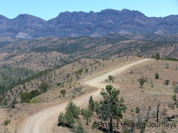
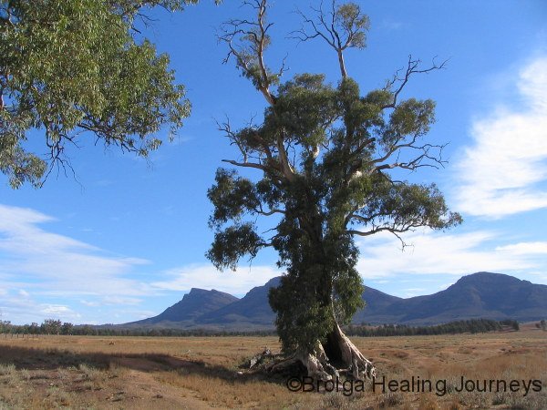
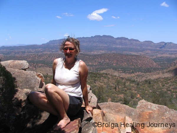
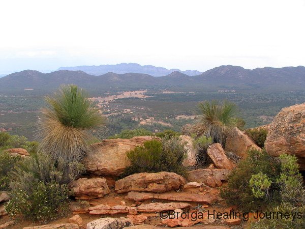
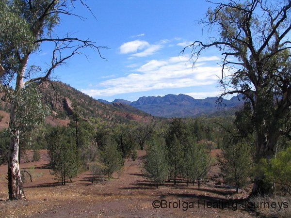
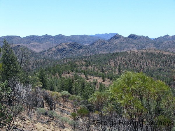
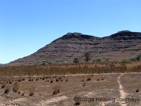
No doubt most of you are aware of Wilpena Pound, a huge natural amphitheatre encircled by high cliffs. No matter where one travels within the national park, Wilpena Pound seems to tower in the distance. But the national park encompasses far more than simply Wilpena Pound, with many other spectacular ranges asserting themselves. These include the Heysen Range, named after South Australia’s famous landscape artist who was inspired by the area of the park now bearing his name, the ABC Range, so-named because its regular mountainous outcrops can be checked off like letters of the alphabet, the Elder Range, and the ancient and heavily eroded Trezona Range. And if that wasn’t enough, nestled among and within these ranges are many rough, steep and beautiful gorges.
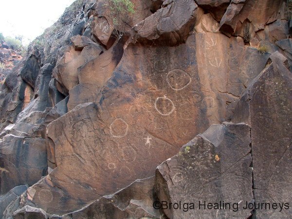
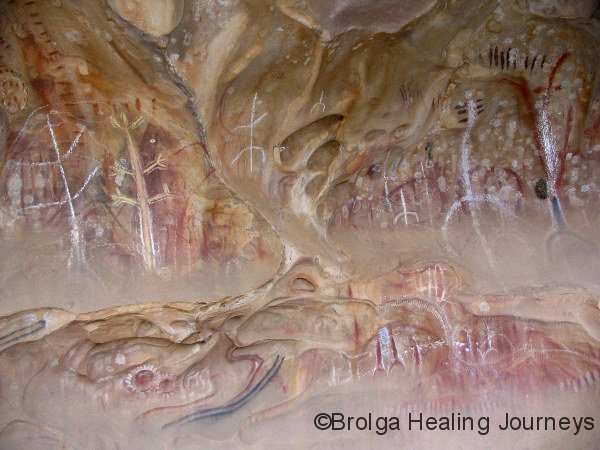
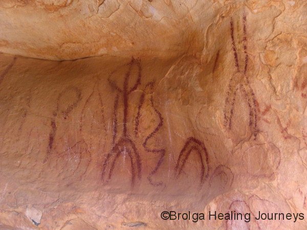
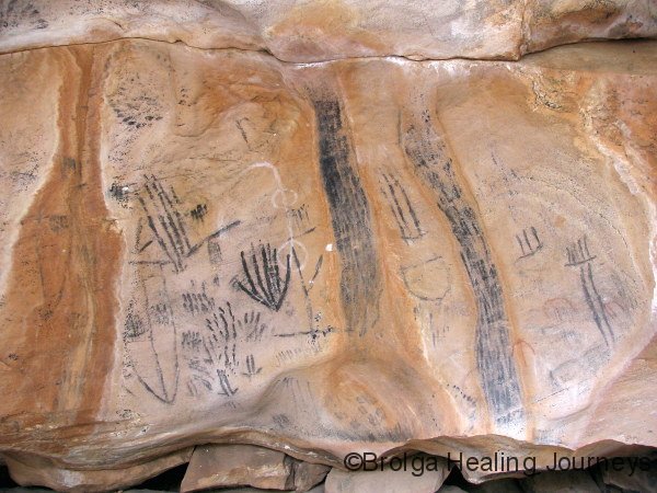
Back to Wilpena Pound. We spent a number of days based there, heading off on various bushwalks. These included the Bridle Gap walk – a trek into the pound, across the centre and up the other side to Bridle Gap – oh yes – and then back again. All done in temperatures in the high 30s. At around 19km all up, this represented the longest walk completed by Nirbeeja. Another memorable, though thankfully shorter walk, was within the Sacred Canyon. This was indeed a very special place, featuring ancient petroglyphs carved into the rock. With such rock art, we found it best to sit and observe the rock walls for some time; the extent and majesty of the art gradually became apparent to us, often high up in seemingly inaccessible areas of the rock. The older the carvings, the more difficult they were to see as they tended to blend more closely with the rock. Walks to other sites on the cliffs surrounding the Pound revealed other rock art sites; more recent, and done with ochres and clay. The art was exquisite.
North of Wilpena Pound we visited the giant red gum made famous by the Harold Cazneaux (grandfather of Dick Smith) with his 1937 photograph entitled “The Spirit of Endurance”. In 1941 he wrote: “This giant gum tree stands in solitary grandeur on a lonely plateau in the arid Flinders Ranges, South Australia, where it has grown up from a sapling through the years, and long before the shade from its giant limbs ever gave shelter from heat to white man. The passing of the years has left it scarred and marked by the elements – storm, fire, water – unconquered, it speaks to us of a Spirit of Endurance. Although aged, its widespread limbs speak of vitality that will carry on for many more years. One day, when the sun shone hot and strong, I stood before this giant in silent wonder and admiration. The hot wind stirred its leafy boughs and some of the living element of this tree in understanding and friendliness expressing The Spirit of Australia.”
Some seventy years after Cazneaux’s photograph was taken, the tree may have lost some length in its limbs, but we are pleased to report that it retains its essential character.

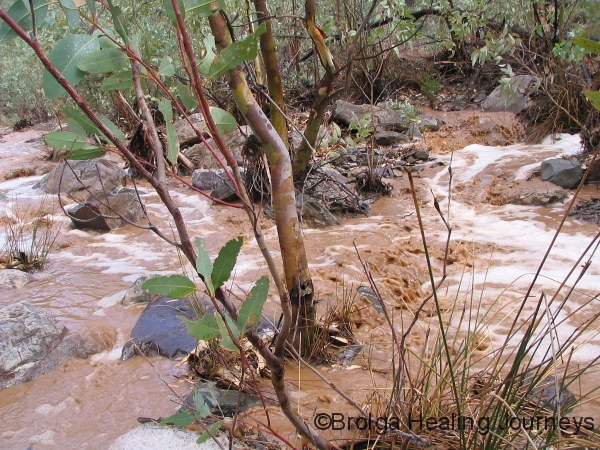
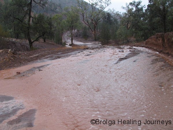
We left Wilpena Pound Resort on a sultry, overcast day and headed north into the National Park. We weren’t overly concerned as light rain started to fall, but began to seriously doubt the wisdom of further travel as the rain became torrential and the wind began to howl. The fury of the storm was both enthralling and terrifying. All the creeks started to flow around us, the dirt road became awash and we drove past a sign warning that the area was subject to flash flooding. Oh no! We could barely see the road and considered pulling over to the side; unfortunately, there seemed nowhere safe to stop. So we drove on, down into the Bunyeroo Gorge, not the most comforting direction to travel because all the creeks, rivulets and streams were now also flowing down into the gorge. We reached the bottom of the gorge as water was starting to rise across the road. We made it across safely, feeling greatly relieved to drive up the road/river to the safety of the elevated Acraman campground. We were then able to jump out of the car and run around like excited children marveling at the flowing creeks, beautiful trees and sheer sense of life brought by the rain. We figure that five minutes later and we would have been unable to cross the river at the base of the gorge. Such is the way of storms in arid regions; the rain stopped after around an hour, and within a couple more hours the creeks and rivulets no longer flowed. For the following couple of days, water remained in rock holes within the Bunyeroo Gorge, but even the major creeks showed little sign of the floods. No matter – the beautiful sight of water rushing through the Flinders Ranges is something we will never forget.
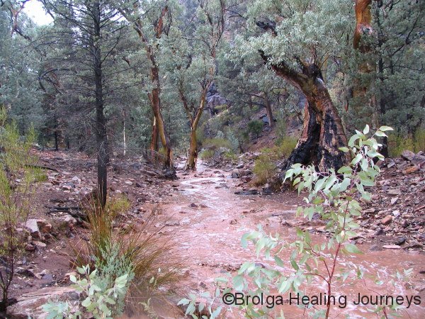
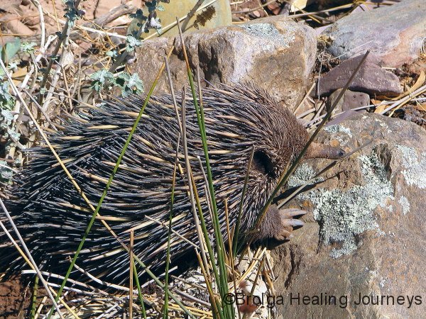
The weather cleared and we witnessed another aspect of the beauty of the ABC Range and the Bunyeroo Gorge region in which we were camped. We looked out the camper each morning to see the ABC range towering above us. By late afternoon the same cliffs glowed orange and red. Down the valley and beyond the gorge, we had views to Wilpena Pound. This campsite was simply gorgeous. We stayed for five days, celebrating Christmas in the most delightful setting imaginable, spending the other days going on the various bushwalks in the area, or just relaxing. One of the highlights from our walks was chancing upon an Echidna, which remained totally oblivious to our presence as it gorged on ants virtually at our feet (see photo).
We ventured further north into the park, staying next at the Aroona bush campsite, near the ruins of the Aroona Homestead, built in 1854, but of which now only foundations remain. Also nearby was the Aroona hut, a relative youngster being built in 1925, and now restored. The hut was built in the pine and pug style (vertical pine logs, with the gaps filled with mud), and was home to Hans Heysen on a number of occasions following 1926 when he painted the surrounding scenery. The Heysen Range across from the campsite was spectacular, in particular the scenery of Hayward Bluff and Mt Hayward.
At this stage our food reserves were getting low, so we took a day-trip to the township of Blinman to stock up. On our arrival, we found that the town consisted of, at most, around half a dozen buildings (one a pub, of course), but all were closed for the Christmas to New Year period. Oh well, back to camp we headed. At least the drive itself proved interesting, and we were to learn that we were indulging in geological time-travel as we headed from east to west on our return. The oldest – the Trezona Formation, had been dated to around 630 million years old, and we drove through a succession of ranges, including the Elatina Formation (620 million years old), the Brachina Formation (600 million), the ABC Range (590 million), ending with the Wirrealpa Limestone, at the relatively young 520 million years of age. Who said Australia didn’t have any history!
Not to be daunted, we drove 70kms the following day to Hawker, the self-proclaimed “Hub of the Flinders”, to get our stores. We had no doubt the supermarket would be open there. Silly us! Closed until 7 January, said the sign on the door. Anyway, at least the service station had some bread and some canned food, along with coffee for Peter; and the drive through the Flinders again proved scenic.
By this time the temperature was soaring into the realms we had expected in this part of the country, climbing to beyond 42 degrees for five days running. We had a shady campsite at Aroona, so we were okay, but shade is the natural enemy of solar panels and, as our fridge worked itself to a standstill trying to keep our food cool, our camper trailer’s battery didn’t fare so well. A quick hookup to the car (with its engine running, naturally) in the early evening rescued the battery. Unfortunately, in order to recharge the camper battery via the solar panels, we set up camp in full sunshine at Trezona bush campground, our next port of call. Here, despite the heat, we welcomed in the New Year, and were interested to watch the local kangaroos digging into the damp sandy river bed each day at dusk for their water supply. But the heat had won, and on 1 January we conceded defeat and headed south, dreaming of cooling sea breezes.
Apart from that one incident with the heat, our camper trailer has performed brilliantly. The battery, which runs the fridge, kitchen and cargo bay lights, our lap top and portable DVD player, as well as recharging all the batteries, has rarely been less than fully charged on solar and car charging. It has become our home away from home.
We reached the township of Quorn, in the south-central Flinders, and decided to stay for a night before moving on. That evening we learned of a colony of Yellow-Footed Rock Wallabies in the nearby Warrens Gorge, so opted for a second day. Quorn proved an interesting town, another full of railway related history, and the drive to Warrens Gorge proved worthwhile, as we observed at least a dozen of the local wallaby colony in the late afternoon.
The next morning we left the Flinders Ranges and drove down the Pichi Richi pass to Port Augusta and the Eyre Peninsula. We had looked forward to visiting the Flinders since planning for our travels, and weren’t disappointed; we would have stayed longer but for the soaring temperatures. The Flinders encompass everything we love about inland Australia; ancient rock formations, enormous gum trees, abundant wildlife and weather extremes.
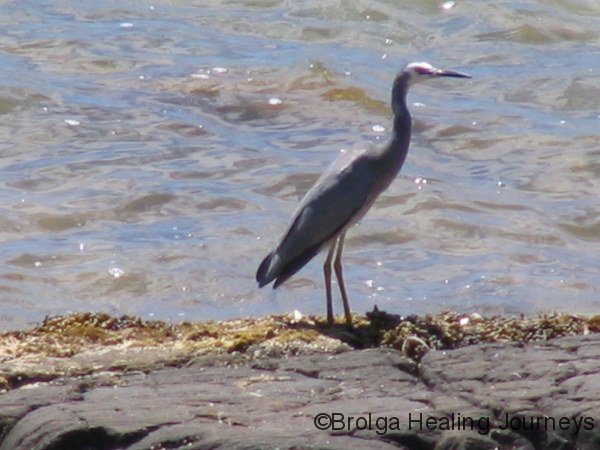
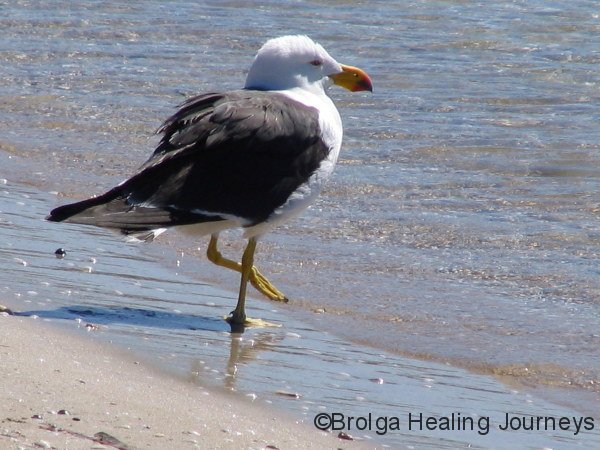
After a brief stop in Port Augusta for supplies, we drove down the east coast of the Eyre Peninsula, passing Whyalla and a number of smaller coastal communities. We camped at Lipson Cove, around two thirds of the way down the coast. We chose a scenic campsite right on the beach and overlooking a rugged coastline. The views were spectacular but the coastal “breeze”, initially a lovely relief from the temperatures inland, was relentless. We enjoyed several days there, walking along the cliff-tops, being entertained by the dolphins in the cove, and trying to identify the many sea-birds in the area.
Our journey southwards continued, passing through Tumby Bay and Louth Bay on our way to Port Lincoln. We were pleasantly surprised by Port Lincoln, a pretty seaside town where tourism now appears to be a major industry along with fishing and boat building. Port Lincoln was our supply point for a couple of forays into the Lincoln National Park, which encompasses the entire Jussieu Peninsula.
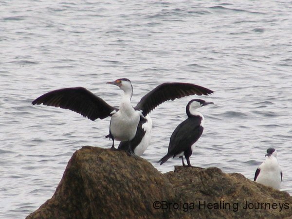
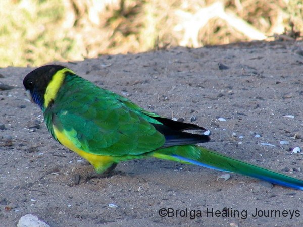
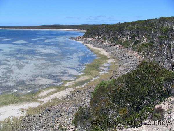
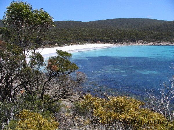
Our first campsite was at Surfleet Cove in the northern part of the National Park. We had our first sighting there of the Port Lincoln Parrot, the western variation of the Ringneck Parrot we had seen in outback New South Wales. Surfleet Cove was an idyllic spot; we looked from our campsite beside a beautiful sandy beach, across the cove to unspoilt wilderness on the headland beyond. Dolphins played in this cove as well, and a number of bushwalks took us further afield. We drove around to Cape Donnington, from which we saw seals on a nearby island, and walked to a beautiful nearby campsite at September Beach. The beaches, rock-pools and coves all sparkled with crystal clear water. This area was one of the highlights of our trip.
![Bond, James Bond! [yeah, thanks Nirbeeja], Peter at September Beach](http://www.brolgahealingjourneys.com/wp-content/gallery/blog-4/eyre-peninsula-282.jpg)
But even better was to come. We had booked to camp for four nights at Memory Cove, a wilderness area in the south of the Lincoln National Park. Daily visitor and camper numbers are restricted via a locked gate, in order to protect the wilderness. Whilst we had enjoyed the northern aspect of the park, this new area simply blew us away!! The cove was perfect, white sands, crystal-clear water, surrounded by bushland teeming with birds and wildlife, including reptiles. We were sitting in our campsite when a Peninsula Brown Snake calmly slithered by, between our chairs, and off into the surrounding bush!
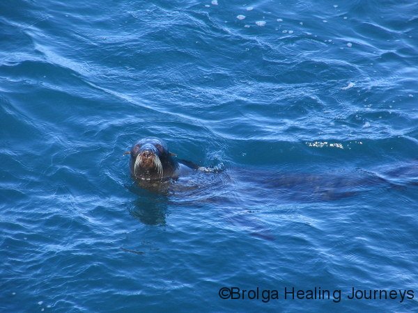
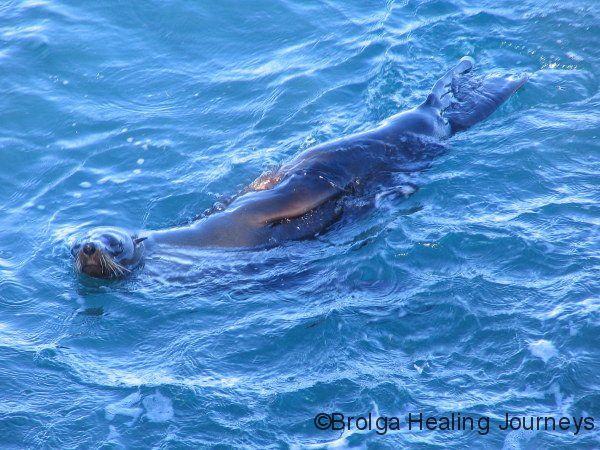
The cove itself featured vividly coloured seaweeds and frequent visits by dolphins and sea lions (although, to be honest, we aren’t sure whether they were sea lions or seals).
A walk to the end of the cove took us to a rocky prominence, from which we were thrilled each afternoon to be entertained, in a performance exclusively for us, by a group of sea lions, frolicking in the rough waves. They were quite inquisitive about us; lying on their backs in the water to look at us, or surfacing frequently to check that we were still there. They seemed quite appreciative of the applause we were giving them for their “aquabatics”. We were only a few metres away from them. The youngest, smallest member of their family delighted in leaping out of the water over the largest of the incoming waves; you could simply sense the glee the youngster felt. We have never had more thrilling encounters with wildlife.
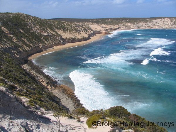
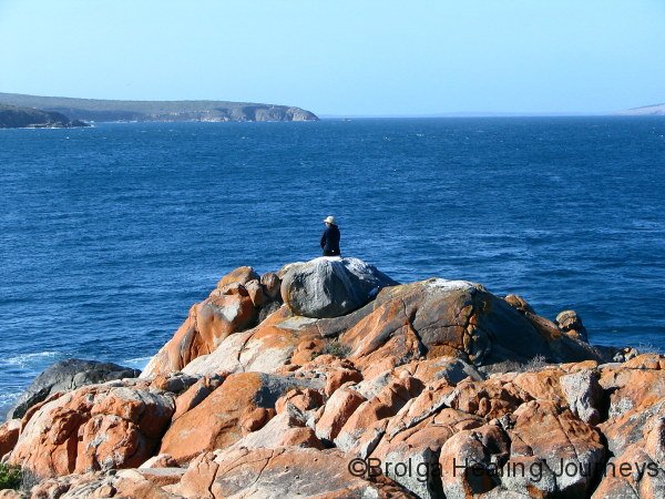
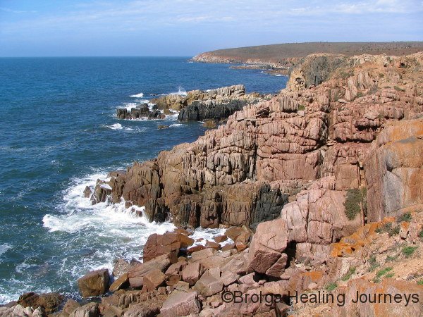
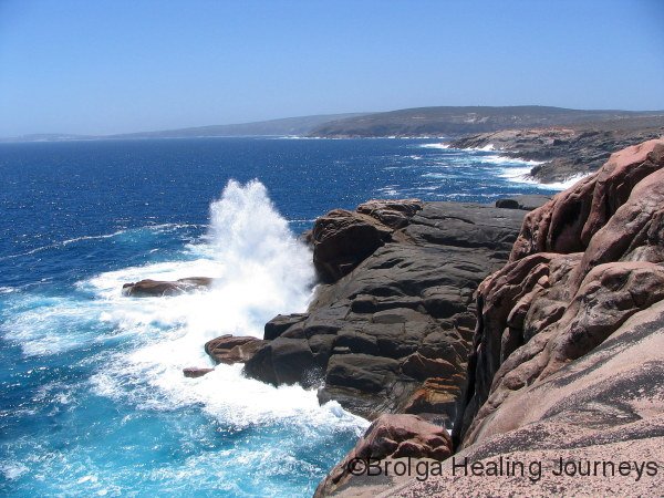
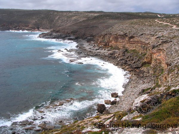
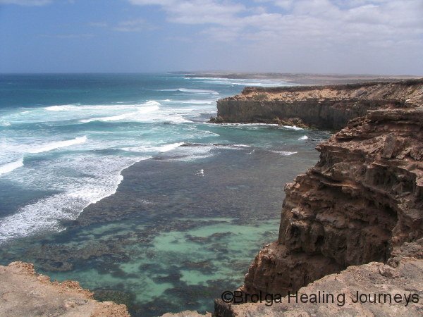
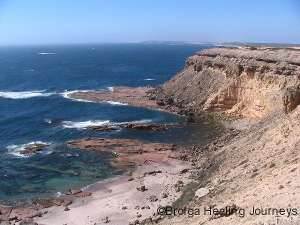
The southern side of the wilderness area is exposed to the Southern Ocean. This features some stunning scenery, with huge cliffs battered by massive waves. The waters were shades of pale green and aqua. The Memory Cove region takes its name from an incident when the wild seas claimed the lives of eight of Matthew Flinders’ crew as he surveyed the coastline of Australia on the HMS Investigator in 1802. He placed a plaque commemorating their lives at Memory Cove, and named surrounding islands after them. We loved our time exploring the region on land, but the names of the some of the surrounding coastal features: Cape Catastrophe, Point Avoid, Avoid Bay, Dangerous Reef, Anxious Bay, for instance, leave no illusions as to the fury of the Southern Ocean when unleashed.
We would have happily stayed in the Memory Cove area for much longer, but our allotted stay drew to a close.
From Coffin Bay we headed up the western coast of the Eyre Peninsula, on the edge of the Great Australian Bight. More wild coastline, high winds and huge surf were the order of the day. We camped at Sheringa Beach, where high winds and a constant battle with fine white dust (from the limestone cliffs) eventually overwhelmed the otherwise attractive scenery and forced us to leave.
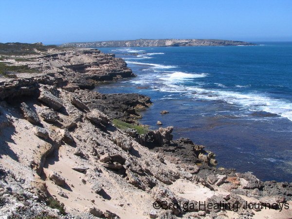
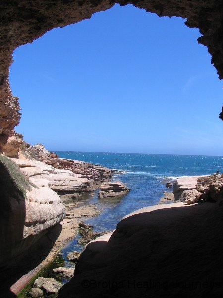
Further up the coast we visited Talia Caves, where the limestone cliffs had been undermined by the ocean to form a series of caves. This was a beautiful spot and we would have stayed longer but for the exposed camping ground. We’d had enough of that for a while.
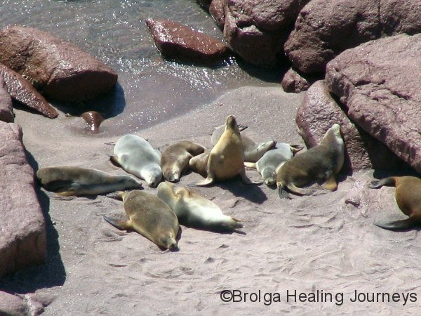
We resumed our drive north, visiting Point Labatt, and from a platform perched atop the 60 metre high cliffs we viewed Australia’s largest mainland Sea Lion colony. These creatures are beautiful in the ocean, but look like huge slugs as they bask in the sun on the rocks. It looks like a tough life! Nonetheless, we found them fascinating, especially the young as they frantically rushed to meet their mothers as they returned from fishing. We counted around 80 in the colony, though no doubt there are many more, as from a distance they blend in remarkably with the rocks. And move about as much.
A long day on the road ended as we pulled in to Streaky Bay, opting for the relative luxury of a caravan park with hot showers and a bay-side campsite. Our second day – yesterday – saw overcast weather and showers – a perfect opportunity to write up this Blog entry. The finishing touches are being done in Ceduna, as we prepare to launch ourselves across the Nullabor Plain towards Western Australia, no doubt for further adventures. We are really looking forward to catching up with our dear friends Richard and Lisa, who are flying across in early March to explore the Margaret River region with us.
Till next time
Cheers
Peter & Nirbeeja
24 January 2008

Nice commentary, great photos, thanks for sharing the journey
Thank you Helen, glad you enjoyed the post.