Blog 3 – Outback NSW, here we come! – December 2007
Hello everyone. We are sitting in our camper trailer on a cool day, writing to you from the Red Banks Conservation Park in South Australia, near Burra. It is trying desperately to rain, but so far not with any great success. Rain would be somehow appropriate, because it was while sheltering from torrential rain at the Warrumbungles that we wrote our last blog entry.
WARRUMBUNGLE NATIONAL PARK (continued from Blog 2)
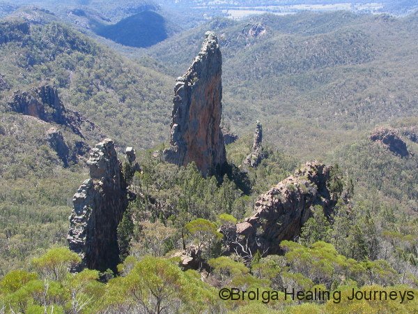
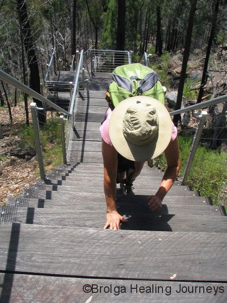
Well, the rain did clear in the Warrumbungles to give us one sunny, perfect day. We made the most of it, and embarked on the 12km trek to the Grand High Tops – a spectacular walk, ascending through woodland and along the Spirey Creek creek, with views of the Breadknife, Belougery Spire, Crater Bluff and other landmarks looming ever closer. The final ascent was steep, though made manageable by the impressive, 200-odd stairs at the top of the trail. Nirbeeja invented her own, unique technique for climbing the stairs (see photo), which she swore by. Peter, interested in preserving his dignity and knees, opted for a more conventional approach to climbing the stairs. The views from the aptly named Grand High Tops were breathtaking, and after days of rain the clear air afforded superb visibility. Each of the majestic, volcanic landmarks seemed almost within reach, yet we knew them to be kilometres away.
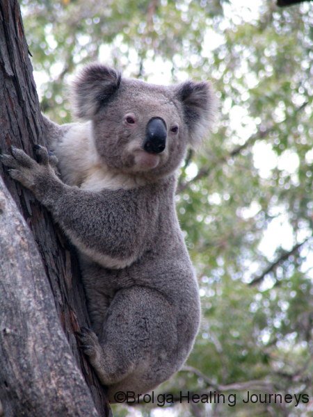
The following day Nirbeeja took a well earned rest, immersed in her reading and birdwatching, while Peter, never to be daunted, took on the 18km loop trek to Mt Exmouth. The weather had again returned to more familiar patterns; rain and wind prevailing. He returned with tales of ascending through avenues of stately eucalypts (“The Boulevarde”), past grass trees, and along slippery paths to the top of Mt Exmouth, the highest peak in the range, so he claims, at 1209 metres. Before his final ascent, he reached Danu Gap campsite where he chanced upon a koala on the path. This was Peter’s closest encounter yet with a koala, and it left him exhilarated for the final part of the climb. The top of the mountain was wild, with squalling winds and rain making visibility poor, but the sheer force of the elements made for a memorable experience.
To view a short, self-taken video of Peter being the intrepid bushwalker, click on the following link:
httpv://www.youtube.com/watch?v=NO8wGbVl_Eo
Our final night in the Warrumbungles saw the culmination of the weather into a dramatic sequence of thunderstorms, which took place over many hours. Lightning struck the surrounding mountains constantly and the whole campground was lit up like daylight. We alternated between being awe-struck and concerned for our safety. Surprisingly, despite being surrounded by storms at fairly close range, we had little rain that night.
NARRABRI & MT KAPUTAR NATIONAL PARK
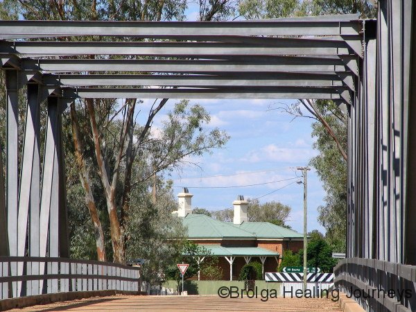
Driving north the next morning revealed where the rain had fallen. Large pools lay along the highway as we headed towards Narrabri and the nearby Mt Kaputar National Park. In Narrabri, we were advised that the park had received high rainfall and heavy winds overnight, and that the road to it was closed by fallen trees and rocks. So our decision was made; we would stay overnight in Narrabri and drive up to Mt Kaputar the next day.
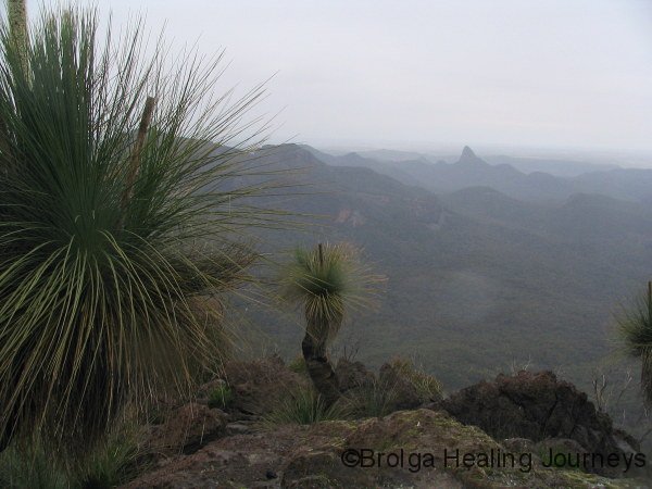
In view of the uncertain state of the road, the following morning we left the camper trailer in Narrabri and drove to the National Park on a reconnaissance mission, of sorts. This was a wise decision, for the narrow road was still treacherous – slippery, muddy and partly washed away in places. The fact that it was cut into the side of steep mountain slopes didn’t inspire confidence. Nirbeeja, the driver for the day, was adamant that we had made the correct choice in leaving the camper in the safety of Narrabri! The cloud was thick and visibility poor. Standing at various lookouts along the road, we tried to imagine the views as we peered into the total white-out, shivering in the damp cool. We both gasped in shock at one point when the cloud thinned momentarily to reveal and ominous rockface, towering immediately above us like some Tolkein-esque vision of doom.
To view a short video of Nirbeeja being cheeky at Mt Kaputar, and coming to grief, click on the following link:
httpv://www.youtube.com/watch?v=Cjon1SjEggI
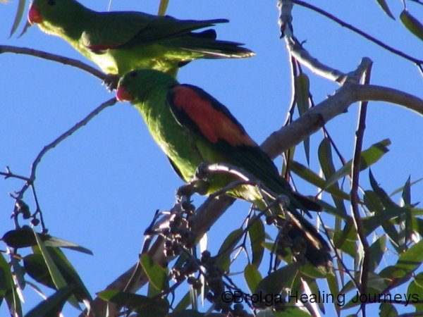
But the weather did clear, and we enjoyed several walks that day, exploring various trails through eucalypt forest, all the while spying on wallabies, King Parrots, Crimson Rosellas and Sacred Kingfishers. We also ventured out to Mt Lindsay, marvelling at the ancient lava field which still showed clear evidence of lava flows.


The campsites at the top of Mt Kaputar were very inviting, but given the uncertain weather, instability of the narrow road up the mountain, and rather precarious limbs overhanging the campground, we opted to remain in Narrabri for the duration of our stay. The decision was confirmed for Peter when a large limb crashed without warning to the ground as he walked around the campsite.
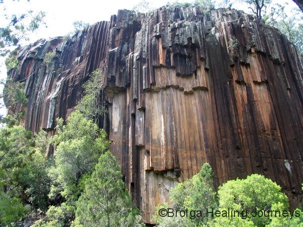
Next day we drove to the northern section of the national park to view the famous Sawn Rocks, regarded as Australia’s best example of the geological formation known as organ-piping. Beautiful and dramatic, these rocks show nature in one of her most creative forms.
Our final day in the park was spent climbing to the top of Yulludunida Crater, a steep bushwalk culminating in a scramble up a jagged volcanic rock-face, affording magnificent views of the surrounding range. On the final morning in Narrabri, Nirbeeja made her first sighting of the Musk Lorikeet in the trees above our camper.
HEADING WEST
The Kamilaroi Highway took us further inland from Narrabri, through Wee Waa and Walgett, to Brewarrina, on the Barwon River, a major tributary of the Darling. En route, we attempted to visit the Cubbaroo winery, the only wine producing property in the north-west of NSW, believed to be unique in successfully producing wine grapes, cotton and wheat side by side. As we turned off the highway toward the winery, we encountered hundreds of cattle on the road. “Oh well” said Peter, “they should be gone by the time we come back from the winery”. So we inched our way through the herd, careful not to startle them nor endanger ourselves or our beloved rig. As we neared the far side, we were greeted by a sign on the road informing us that the winery was closed. If only they could have told us at the highway turn-off, with their main sign… Next followed a U-turn, camper trailer in tow, on the narrow dirt road amidst bewildered cattle, then the slow passage back through the herd to freedom. A bemused cow-cockie watched our trip into the depths of the herd and our equally slow trip back out – we can only guess what was going through his mind!
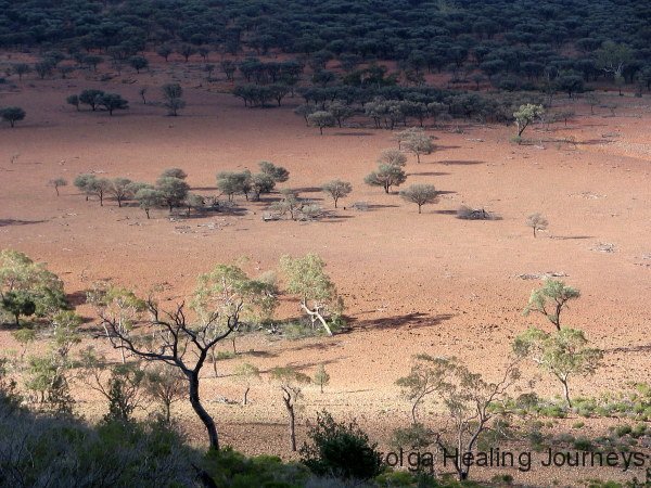
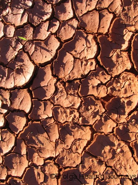
We enjoyed the drive inland, watching as the countryside and vegetation went through subtle changes. Driving may take longer than plane travel, but gives you a greater appreciation of the country you are travelling through. The trees gradually thinned out and became shorter and hardier. Eventually trees became concentrated along riverbanks, usually river red gums, though we also saw pockets of mallee and mulga. The earth became the gorgeous deep red for which the centre is famous. Sure, it gets in everything, on your skin, in your clothes, in the car, but you forgive it when you see the magical glow of the early morning or late afternoon.
BREWARRINA
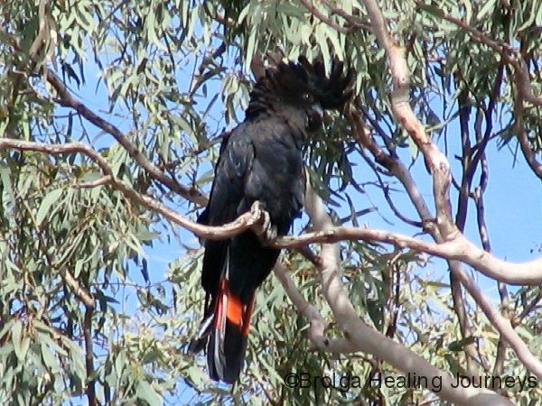
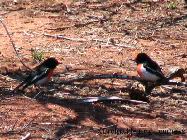
Near Brewarrina, we camped at the Four Mile reserve, next to the river and about the same distance from town as its name would suggest. Here we pulled out the swags for a change. The abundance and variety of birdlife in the area soon made itself known and in a surprisingly short time Nirbeeja proclaimed “We are never going to leave”. The most striking were the hundreds of Red Tailed Black Cockatoos flying across the river to roost in the trees on the opposite banks, then back again to feed in the trees and on the fields on our side of the river. They spent much of each day flying to and fro, to our great amusement. From his swag one morning, Peter counted over 300 in the fly-past, but swears many had already flown by before the tally commenced. The other birdlife was slightly less obvious but no less abundant. Species identified by our resident “expert” include Willy Wagtails, Pee Wees, Mallee Ringnecks, Rainbow Bee-Eaters, Galahs, Pied Butcherbirds, White-Browed Treecreepers, Sulphur Crested Cockatoos, Red Rumped Parrots, White-Browed Woodswallows, Australian Raven (the Crow), Tree Martins, White-Winged Choughs, Peaceful Doves, Restless Flycatchers, Crested Pigeons, Sacred Kingfishers, Pelicans, Pacific Black Ducks, Great Egrets and Cormorants. And these were all sighted from the campsite. We saw a couple of other species but they remained unidentified.
Brewarrina, affectionately known as Bree, is a town that typifies the challenges facing outback NSW. The drought has hit the region hard and these once thriving river ports are struggling. Social, racial and alcohol problems have compounded the challenges. Some of the towns have a shut-down look to them and the temptation for travellers is simply to drive through without stopping. Interestingly, on the road approaching Brewarrina there are several prominent signs– the first states “Want to help?” The next, some 100 metres on, says “Stop and spend $20”. It took a moment for the message to sink in. If most visitors/tourists did stop and spend such an amount in the town, the local economy would get quite a boost. Businesses would survive, employment would persist and the towns could more readily prosper. This message, which by all accounts has caused some controversy in Brewarrina, has certainly increased our awareness of the small part we can play in helping these historic towns to survive. They are the heartbeat of Australia, central to our identity, and if they perish then so will much of what it means to be Australian, and we will become little more than a cultural outpost of the USA.

History is very much part of the fabric of Brewarrina, for she boasts among the oldest human structures in evidence, in the form of the Brewarrina fisheries. These rock fish traps, are the largest and most complex set of functional Aboriginal fish traps ever recorded, and are estimated to be over 40000 years old. The following is quoted from material provided by the Brewarrina Information Centre, staffed by very friendly and helpful local indigenous people:
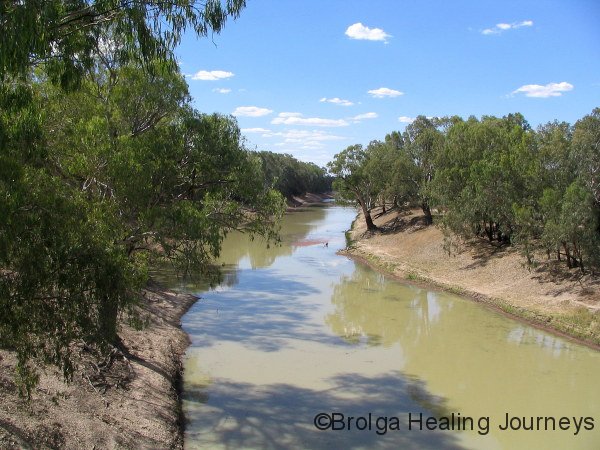
The rock traps are situated at the north west corner of the township below the rock bar lying across Gurrungaa, the large waterhole on the Barwon River. In a distance of 400m the river falls 3.35m as it flows over a series of 4 shallow rapids from the site of the fisheries, known as Ngunnhu, to the last of the rapids, where it deepens into the river channel.
In Aboriginal traditional accounts, Baiame, the creator spirit, and his two sons, Boomaooma-nowi and Ghindi-indao-mui, built the fisheries during a great drought. Gurrungaa, the waterhole at Brewarrina, had dried up and the Ngembe people, faced a famine. Each tribe had its particular yards and for another to take fish from these is theft. Tribes keep their yards in repair, replacing stones removed by floods and so on. Baiame also decided that there should be a camping ground, in common for the various tribes where during the fishing festival, peace should be strictly kept, all meeting to enjoy the fish, and to do their share towards preserving the fisheries.
Originally there were many more fish traps, they fell into disuse following the decline in Aboriginal population; the establishment of the mission station further up the river; the use of the rock bar by the early settlers; and the damage caused by river steamers and floods.
In 1901 R.H. Matthews wrote this description of the process: “during the early spring months of the year, or at any time, there was fresh flow in the river, the fish travelled upstream in immense numbers. The stone pens or traps had their open ends towards the direction from which the fish approached… As soon as a sufficient number of the finny tribe had entered the labyrinth of traps, the openings were closed by means of large stones which had been placed alongside ready for use… The natives next entered the pens and splashing the water with their hands or feet, thus frightening the fish into the smaller enclosures where they were more easily caught.”
The fish traps are still obvious, and on the day we visited them, Yellow Belly (Perch) were abundant. The river, however, is sadly littered with modern “relics” and also in need of better water flow. It is hard to believe that the Brewarrina Fish Traps, such a human treasure, are largely unheralded. Perhaps our own culture could learn from the river management philosophy once practiced at Brewarrina.
On a lighter note, the local constabulary made quite an impression on Peter. Looking as though they were straight out of McLeod’s Daughters, one morning two glamorous policewomen, blonde hair beautifully coiffed and their make-up immaculate, drove through the campsite to check that all was okay. Despite Peter’s offers, they suggested there was no need to take him back to the station for further questioning.
BOURKE & AN UNEXPECTED MEETING
Nirbeeja left the avian paradise of Four Mile reserve somewhat grudgingly, as we continued our journey along the Kamilaroi Highway towards Bourke. Narrabri claims itself to be the “Gateway to the Outback”, yet signs on the approach to Bourke claim it to be the “Gateway to the Real Outback”, but who cares, it all seemed outback to us.
Our journey to Bourke and the region was largely inspired by performances at the National Folk Festival in Canberra two years ago, by Bourke musician Tonchi McIntosh and his long-time friend, Poet/Artist/Musician Andrew Hull. Their vivid stories about the towns, history, characters and bush around the area, and in particular an hour-long series of compositions about the town of Louth, captured our imaginations. We needed to consult a couple of maps to locate Louth, and eventually learned that it resides approximately 100km downstream from Bourke on the Darling River.
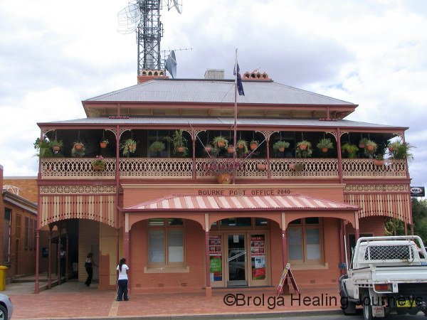
We arrived in Bourke, with no great expectations, having heard unflattering reports from former visitors. Our experience was quite to the contrary; we entered a town proud of its history, an oasis in the drought-stricken desert, with well kept streets and charming historic buildings, mostly in good repair. The people in Bourke are welcoming, helpful and friendly.
As we walked the main street, we discovered on a table in the local gift-shop, to our great surprise, a new book of poetry by Andrew Hull (“Hully”), and were thrilled to learn that he worked around the corner. A couple of phone-calls later by Carol, proprietor of the shop, and a meeting had been arranged to have our newly purchased book signed by Hully himself. We’re not sure who was more thrilled – us, to meet him and have our book signed, or Hully, to learn that people had seen his and Tonchi’s performances in Canberra, and were now visiting the region largely through the inspiration of their work. Hully was a fantastic bloke, very friendly and generous with his time and stories. Apart from the many artistic strings to his bow, Hully works for the river-management area of local council, and is passionate about the health of the Darling River. No doubt his work colleagues joked later about a couple of groupies turning up from interstate!
As happy coincidences are want to happen, Hully informed us of, and invited us to, the official launch of his book and art work, later that very week. A further coincidence was that shortly prior to meeting him, we called in to the local National Parks office to enquire about the nearby Gundabooka National Park, and were greatly impressed by the friendliness and helpfulness of one particular lady. Her enthusiasm for the park was obvious; she almost leapt the counter to inform us of its attractions. We later discovered that she was none other than Hully’s wife, Melissa.
GUNDABOOKA NATIONAL PARK
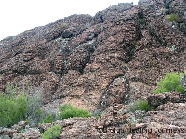
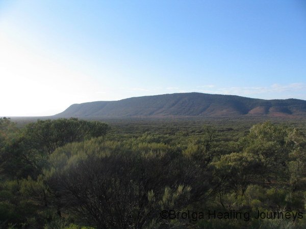
As there were still four days to the book launch, we decided to spend that time at Gundabooka NP, located about 50km south of Bourke, off the Kidman Way. By now, attentive readers would no doubt be aware of our great partiality to national parks. They epitomize, for us, the natural beauty of each local area. And Gundabooka was no exception. “This is stone country” states a sign erected by the traditional custodians of the region. Indeed it is! Stones great and small, from pebbles to those bigger than a house; we loved every one. The ancient Gundabooka range towers majestically beyond an expanse of Mulga, with an occasional taller Beefwood punctuating the scene.
Our first glance did not reveal much in the way of wildlife in the park, but as we adjusted to the rhythms of Gundabooka we noticed emus, rufous whistlers, mallee ringnecks, mulga parrots, chestnut-breasted quail-thrushes, red-capped robins galore, brown treecreepers, bronzewing pigeons and western-grey kangaroos.
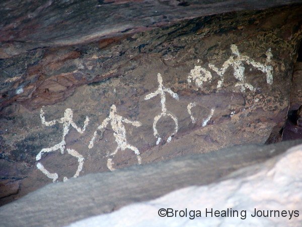
The “Dry Tank” camping area is simple but clean, and provides a good base for enjoying the park. We were fortunate to have it to ourselves for the duration of our stay. From the campsite, a path leads to the Little Mountain lookout, with splendid views across the valley to Mount Gundabooka. A drive further around the park took us to the Mulgowan (Yapa) art site in the Mulareenya Creek region of the park. This was a beautiful place, with huge boulders lining the dried creek and dramatic artwork under rock overhangs depicting local ceremonies.
The following day, Peter was in an adventurous mood, and walked across the valley (and back) from the Little Mountain lookout to Mt Gundabooka. The walk was probably about 3-4 km each way, and there were no paths to follow. The Mulga was thick, in places badly affected by drought, and the changes in terrain were interesting, with some areas nearer Mt Gundabooka incredibly rocky, resembling fields of gravel. The return journey provided Peter with an interesting exercise in navigation (which he is happy to report he passed). There were no obvious landmarks to aim for, as the Mulga on the valley floor completely obscured any distant view of Little Mountain. Fortunately, Peter had anticipated this problem and had set off with trusty Sat Nav in hand and a number of compass bearings in reserve.
Again Nirbeeja chose to either read or do some bird-watching in shady spots. You know how the saying goes… “only mad dogs and Englishmen…” Well as she claims to be neither, her more active pursuits such as yoga or walking are relegated to early mornings or late afternoons.
That night we were entertained by a dramatic thunderstorm crossing the region, and the following day we ventured to Bennet’s Gorge, climbing a good way up Mt Gundabooka in the late afternoon before fading light forced us back. The late afternoon views from the mountain, across the Mulga plains, were timeless. Amazingly, in this stony environment we sighted many kangaroos and wallabies.

BACK TO BOURKE
Friday had arrived, time for our return to Bourke for Hully’s book launch and art show!
It was a very entertaining evening, with a huge turnout. His art show was combined with a fellow artist and by the end of the evening they had sold the majority of their work. There were certainly some fine pieces which we would have loved to acquire, but with a long journey ahead of us this was not possible.
Hully, of course, was also doing well in sales of his book of poetry “West – People and Places”, and recited a couple of poems to musical accompaniment. We purchased another copy for our friend Poppy who was with us at the National Folk Festivals, as she too was familiar with his work. (She later delightedly informed us by email that she received the book on her birthday – another happy coincidence).
Hully’s book is self published, and can be ordered from his website www.hullyjoe.com We highly recommend it! His poems are inspired by Bourke and the NSW outback, drawing on the region’s history, its characters, their struggles and triumphs, his own experiences, and the writings of Henry Lawson. His work is at times humourous, at others deeply moving, and continues the Australian bush poetry tradition. With Hully’s kind permission, we have reproduced one of his poems at the end of this blog.
We greatly admire the work Hully and his friend Tonchi McIntosh (now based in Melbourne) are doing to keep the stories of the bush alive. In one of their collaborations, they tell the story, through music and poetry, of the township of Louth and the grave of one of its pioneer settlers, Mary Mathews.
LOUTH
Which takes us on the next part of our journey, to Louth. Ah, Louth. Dear Louth! This place and its people (34 adults, by all accounts, plus children) are very special to us.
But first, let us explain a little about Louth, and its history, which is essential to the story and our visit.
A BRIEF HISTORY OF LOUTH
In the 1850s, there were no real towns along the Darling River between Wentworth and Walgett, a stretch of about 1300km. Occupation was officially sanctioned in the west of NSW in 1857 and by 1860 there were large and scattered stations in existence which included “Toorale”. The many Public Inns scattered along the river were the only reprieve for the weary swagmen and teamsters travelling along the Darling.
In January 1865, after working on Toorale Station as a blacksmith, an Irishman named Thomas Andrew Mathews took up a 40 acre selection on the Darling River, which he named “Louth”, after his native home in Ireland, and built the Daniel O’Connell Public House. “TA” as he became known, steadily built up his stock numbers as he increased his land holdings, and with the idea of creating a town, he set aside land for this purpose. Soon after, houses were built and a bonded store set up for the storage of goods from the river boats. With the assistance of his wife Mary, who followed him to this country some years later, and who ran the Daniel O’Connell, and with their growing family to help him, TA set up a blacksmith, built houses and repaired and made anything that was needed. Louth also became a drop-off point for ore from the Cobar Copper Mining Company. The ore was quarried in large blocks and transported by teams to Louth. The ore was then stacked, awaiting shipment to the smelters at Port Adelaide when the river was high enough for the steamers to run. On their return run, the bullock or horse teams would then cart water from the river back to the mine.
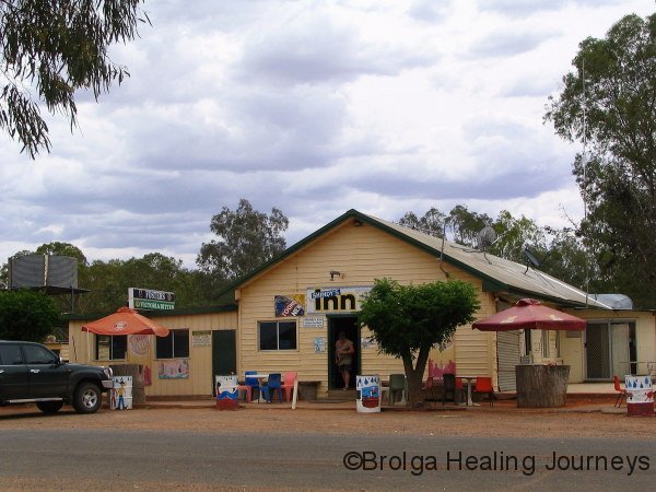
A Post Office for Louth was established in the Daniel O’Connell hotel in 1869 and was also run by Old TA until it closed in 1871. The Post Office was re-established in 1873 and run out of the store until “The Louth Post and Telegraph Office” was built in 1888, this building continued to serve the people of Louth until it closed its doors for the last time on 28 June 1991. Louth also had its own Police Station which was built in 1918 and remained in use until 1945. It was then used as a private home until the early 1950s when it was pulled down and removed. Louth also had its own stores (the last closed in 1980) and in the 1880s and the early 1900s had several hotels, including the Commercial, Post Office Hotel, Telegraph Hotel, Louth Hotel (this replacing the Daniel O’Connell after TA transferred the licence to Wittagoona in 1885), and the Royal Hotel, which stayed in operation until it burned down in 1956, and was replaced by the present hotel, Shindy’s Inn. The only commercial premises now operating in Louth are Shindy’s Inn, a Bed & Breakfast (in the former Post Office) and a tiny caravan park.
Work started on the bridge across the river in 1961 and the men worked between both Louth and Tilpa (whose bridge was being built at the same time) as the building supplies became available to each site. This process continued until the bridge was finished and officially opened in 1965. Today Louth is mostly known for its annual race meet which started in 1959, after a group of men who attended the Cobar Races got talking and decided to hold a race meeting at Louth.
THE MONUMENT TO MARY MATHEWS
We return to the aforementioned collaboration between Tonchi and Hully, which focused on the monument erected by TA Mathews to the memory of his first wife, Mary Mathews. This monument is arguably one of the most impressive and certainly the most innovative to a lady’s memory.
Mary Mathews died at Louth aged 42, and the magnificent Victorian dark grey granite monument, some 24 feet high, that holds a Celtic cross above her resting place was so skillfully designed and positioned that at sunset each day it reflects the suns image into the village of Louth. On the 19th of August, the anniversary of her death, the reflection from the cross is able to be seen from site where “The Retreat”, which was her home, once stood.
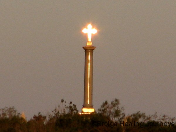
Recent scientific analysis with the assistance of GPS technology has established the tremendous accuracy which with the surveyors and ships’ captains of the 1870s were able to set up this truly outstanding engineering achievement.
With the sun setting in a slightly different position on the western horizon each day, its reflection shines back into the village at a different spot, and in fact it travels a kilometre and back each year along the village boundary. Anyone visiting Louth, can observe, just before sundown, this spectacular reflection for just three minutes. The exact viewing spot varies each day.
For anyone interested in a more extensive history of Louth, TA Mathews and the Monument, we have attached the “Blog 3 – Supplement – Louth & Mathews” for further reading. We warn you – it is long – but it makes for fascinating reading if you have the time and gives some wonderful insights, we feel, into the region, its incredible characters and their achievements. The story of the construction of the monument in Bedigo, its shipment up the Darling River on the steamship the Jane Eliza, and its final journey across country to Louth when the Darling dried up, is an epic in itself.
We were fortunate to view the monument’s reflection on five separate evenings in Louth, and can fully attest to its beauty and wonder. The Celtic Cross atop the monument produces a dazzling golden light at sunset, with the pillar supporting the cross and the base of the monument also glowing. The local keeper of this story, Wally Mitchell, tells of when he first saw the reflection as a boy and copped a clip under the ear when he ran to his father screaming that the cemetery was on fire!
OUR EXPERIENCES IN LOUTH DISTRICT
Our first port of call on arriving in Louth was Shindy’s Inn, where we met its publican Cath, who greeted us with a friendly smile. We were entranced by the old photos on the pub walls and the general atmosphere of the place. We got talking to Cath, and when she learned that Peter was a naturopath, she offered for us to put up a sign in the pub window. Cath also very kindly accompanied us across the fields in town late that afternoon to show us the appropriate place to stand for our first viewing of the famous sunset reflection of the Celtic Cross. That sight is something we will always remember. Cath also invited Nirbeeja to a local weekly yoga class (affectionately known as the torture session by the locals), as a participant.
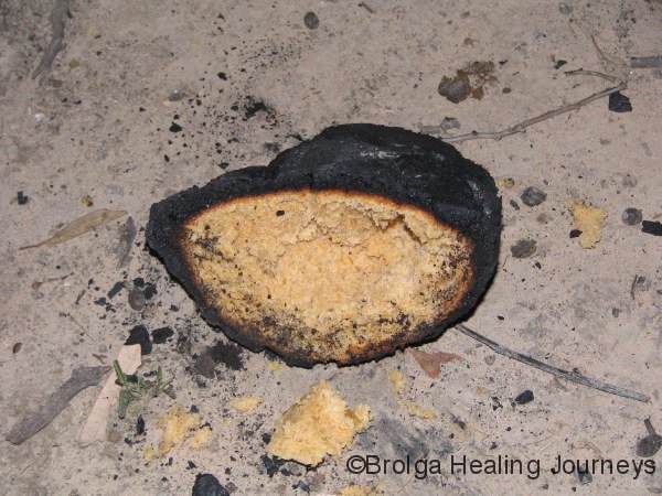
We had already planned to stay for a few nights camping at the (relatively) nearby Trilby Station, on the Darling River. So off we headed, spending those days relaxing at the campsite, yabbying in a dam on the property, bird-watching, reading, and exploring the large Trilby property in our 4wd, guided by the “Mud Map” the locals provided. Peter also made his first attempt to cook damper while camping there (see photo for result).
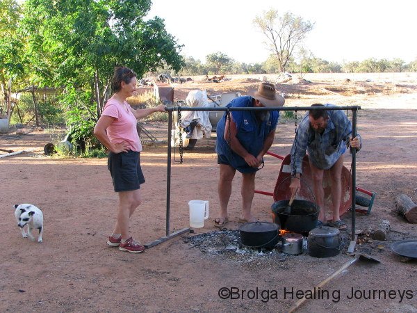
Peter had by now learned that he had one consultation booked on his return to Louth, so we left Trilby with the plan to stay for one night in town before travelling down the Darling. We ended up staying for 8 nights in total and had the time of our lives. Word spread quickly via the bush telegraph that there was a visiting naturopath in town, so Peter was kept busy over the rest of his time there. Thank you Louth for your support and acceptance of these two strange visitors! We were treated like old friends by the town; we woke one morning to find a dozen eggs outside the camper (thanks Patsy!), and were treated to an absolute feast by the McMaster boys Ian and Kevin with their masterful use of camp ovens. They also showed us some of the finer points of damper making with astounding success. The camp oven feast was organized by Ian’s wife Julie, who became a great friend to us during our stay.
Peter had the pleasure of a round of golf while in town, with clubs provided by Shindy’s Inn – somehow appropriate – and golf balls provided by Julie. He had an inkling of what to expect when the night before he played he asked whether the course had grass greens or sand greens. Dave, the publican smiled quietly and Julie sat thoughtfully at the bar in Shindy’s, before replying along the lines that maybe they would be green if ever it rained. It was a golfing experience that will be hard to match. Peter hit a tractor with one slightly wayward shot (he swears the tractor was parked in the middle of the fairway), had a ball stolen from the middle of another fairway by a crow – a local hazard, by all accounts – damn nearly got sunstroke, was amused by the sign on a tree beside the third tee which simply said “Mens”, and finished with a par.
The people of Louth live in a tough environment and have been through a prolonged drought, but their spirit is still strong and they are full of humour. These are tough people, from many generations of strong stock. Peter has never seen so many silk irises in his iridology practice– indicating strong, robust constitutions. He found the people an absolute pleasure to treat. Dorothy Hall, Peter’s iridology and herbal medicine teacher, would love the people of Louth.
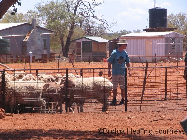
In town we met a true bush character and gentleman, “Johnny Mac” (the father of Ian and Kevin of the camper oven fame), who at 68 years of age is still shearing and as fit as a mallee bull. Johnny Mac has a profound knowledge of the bush in what he calls the “back country”. Our introduction to him was to observe his gentle handling of a beautiful ochre-coloured lizard, which he had found in a pile of wood that he had collected in the bush. We learned that he planned to return the lizard the following day to the bush, even though that was some distance away – because that was where it belonged, he said. Over the years Johnny Mac had also worked for the CSIRO in the local area. We were able to visit his shearing shed and property while in Louth, and were treated to some of his home-grown vegetables; he has grown the largest red onions we have seen. It was an honour to share a “couple” of drinks with him at Shindy’s, though Peter suffered for it the following day!
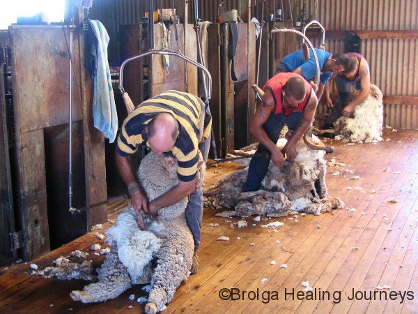
For our final day in the region, we travelled to the nearby Ballycastle property, only some 70 odd kilometres away, to observe a working day at a woolshed. It was a stinking hot day, and we can only marvel at the shearers who worked in those conditions, under a corrugated iron roof with no insulation, with the heat beating down through the iron. We are unsure just how hot it was at the station, but the temperature had cooled to a more pleasant 42 degrees by 6.30 pm on our return to Louth. At the station, Nirbeeja found it slightly more bearable outside under a tree with only the hot wind to contend with. Peter was enlisted to help in the sheep yards, where everything felt like it had been put in an oven; the metal rails and fences were virtually too hot to touch. Even the seasoned station hand, who foolishly worked in the yards without a hat, retired with sunstroke, leaving the “newchum” Peter to assist the stationowner’s son in branding and dipping the sheep. We have developed a newfound admiration for those on the land, and especially for the underpaid shearer.
Later that evening, as we replaced lost fluids in Shindy’s Inn, the station owner rang to seek assistance in the sheep yards the following day. Peter resisted the temptation to go back for more, and besides, we were planning to leave the next day.
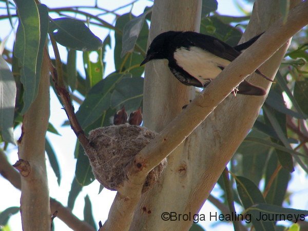
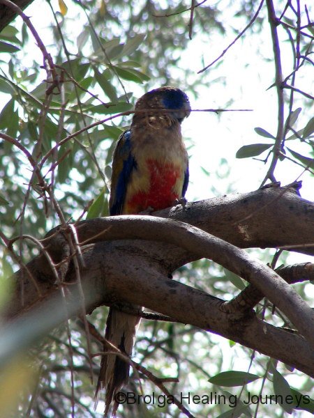
We saw our first Red Winged Parrots and Blue Bonnet Parrots during our stay. We also were entertained by the local flocks of Corellas and discovered a Willy Wagtail nest, containing three chicks, next to our campsite.
We witnessed a great community spirit in Louth – where everyone helps out. We’d notice someone doing work in one part of town and later see them helping out somewhere else. Nirbeeja was caught up in this sense of community and helped out with cleaning at the school and in the caravan park, as Julie’s off-sider. And it was during this work ethic that Nirbeeja introduced Julie to the wet tee shirt concept – no, not contest – concept – to help stay cool in extreme heat. It works!
Everyone in town made us welcome, with special thanks to Cath and Dave at Shindy’s Inn, and the beautiful, colourful and engaging Julie (no Julie, we won’t forget you).. Peter felt more at home in Louth than any other place he has lived in or visited. We hope to make it back to the annual Louth races, in August 2008, if not before.
Farewell, dear Louth, till we meet again!
PS Shindy’s Inn now has its own website, from which you can book accommodation for a stay in Louth. As you can probably guess, we’d recommend it highly. The website is:
http://www.shindysinn.com.au/
Our next blog will continue our journey into South Australia. We will quit for now before RSI sets in.
Peter & Nirbeeja
15 December 2007
Andrew Hull’s Poem from his book “West – People and Places”.
Reproduced with the permission of the author.
WEST
West was the chance for adventure, romance
And a life that was not ‘handed down’
Where the idealistic and unrealistic
Escaped both rank and renown
The future unplanned save for hope of a land
That was borderless, open and blessed
So men without fear gave up kin and career
To rebuild themselves in the West
West was the break for women to take
And trade circumspection for chance
But hearts became broken when words left unspoken
Were lost in a new circumstance
Some would return with the power to learn
From a land without leisure or rest
And futures were made by the women who stayed
For their strength was the heart of the West
West was the seed of a pioneer breed
Who pushed beyond river and range
To enter a scene both harsh and serene
And a future both savage and strange
Where soft summer rains and wide open plains
Saw visions of great wealth impressed
And people despised for land which they prized
Saw bloodshed come to the West
Battle drums beat when different worlds meet
And deeds that few could condone
West saw the blindness, the fear and unkindness
And secrets untold and un-shown
Bent to submission and herded to missions
The children were born to unrest
And a culture was lost at a terrible cost
That is still being borne by the West
West was the place where respect earned a place
And men stuck to men as a creed
And those with the drive could prosper and thrive
And take over title and deed
Here was a land where an empire was planned
And fortunes that few could have guessed
So bridges were burnt and lessons unlearnt
As industry came to the West
West was the story of power and glory
That poets and writers relayed
And men took the track with their life on their back
To go where ‘the future’ was made
And when came a war the West was the core
Of the spirit considered the best
So in far foreign fields a concept was steeled
And a nation defined by the West
West was the scene for seasons extreme
With heat and with plague and with flood
And paddocks so dry that they blew to the sky
To fall again elsewhere as mud
With banks undecided and stations divided
Returning men claimed their bequest
But most would lose out to the vermin and drought
And the rest blew away in the West
West ran the courses of new market forces
As dreams were still finding their way
And schemes that were tried were often denied
So some were unable to stay
Then many small towns of respect and renown
Were lost, save a few dispossessed
Who laugh as suns set over doubts and regret
That’s how people laugh in the West
West now is a trial of will and denial
And hopes that are beaten and battered
Forgotten dreams that split at the seams
In hearts that are shaken and shattered
But it lives in a song for the sacred and strong
Who cling to the will in their breast
And wait for the chance of adventure, romance
That is still to be found in the West.
